Oil and Gas 101 Educational Animations
Educational Animations 101
Learn more about some of our most watched oil and gas 101 educational animations.
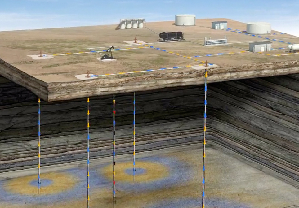
Permian Basin
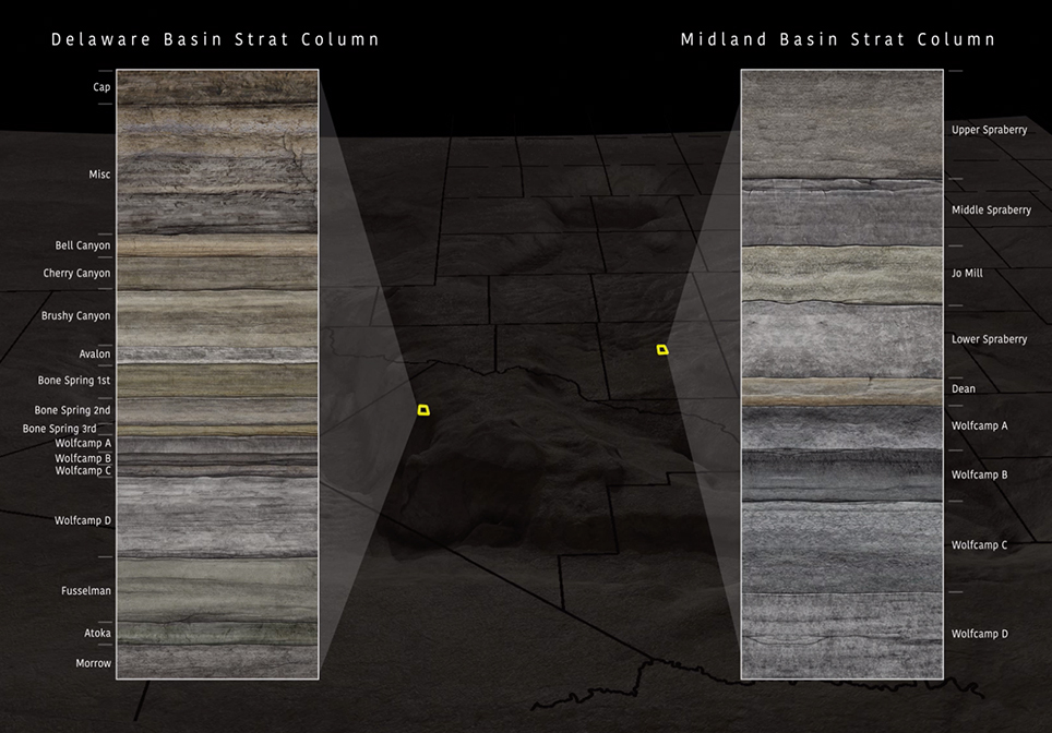
The Permian Basin covers an area 250 miles wide and 300 miles long across west Texas and southeastern New Mexico. It has been the most active oil play in the country with companies aggressively acquiring new acreage across the region.
Leasing acreage in the Permian has been fast-paced with companies continually trying to expand their holdings across the region.
The prize? First class stacked benches or pay zones in both the Delaware and Midland Basins. This offers multiple reservoirs to be drilled horizontally and completed using sophisticated reservoir optimization.
The Delaware and Midland Basins have some common attributes such as lithology and age but differ in other ways. The deeper Delaware has numerous potentially productive stacked pay reservoirs formed from deep water deposits of marine life.
Waterflood
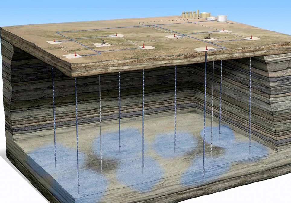
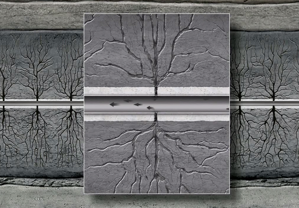
Waterflooding is a method of secondary recovery in which water is injected into the reservoir formation to displace residual oil and typically follows primary production. It is the most frequently practiced secondary recovery displacement mechanism.
As the water enters the formation it sweeps some of the remaining oil in the pores towards a producer well improving the production and extending the life of the well. A waterflood can typically produce an additional 10–20% of the oil in place.
Multi-stage Vertical Frac
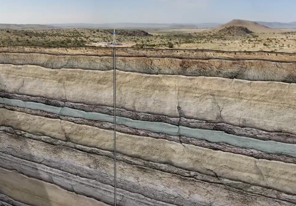
This Multi-Stage Vertical Frac Crude Oil Animation explains and demonstrates how a vertical well is drilled, stimulated and produced from multiple formations to recover hydrocarbons. In this animation, we show a well targeting three sandstone layers. The well is initially drilled to a designated distance below the deepest fresh water source near the surface.
Impact Crater
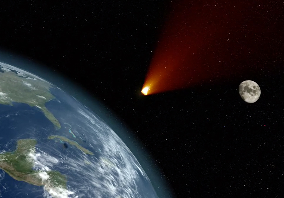
The 10 biggest impact craters on Earth date back from 35 million to over 2 billion years ago.
When an asteroid or meteorite crashes into the surface of a planet or a moon, a circular depression is formed. To form a true impact crater, this object needs to be traveling at super-fast speeds – many thousands of miles per hour! It immediately vaporizes and creates enormous shockwaves through the ground that melt and recrystallize rock and are one of the most destructive forces in the solar system.
The Chicxulub crater, sometimes referred to as the deadliest location on earth, is buried beneath the Yucatán Peninsula in Mexico. When the Chicxulub asteroid slammed into Earth about 66 million years ago, it obliterated 80 percent of Earth’s species, blasted out a crater about 200 kilometers (124 miles) across and 19 kilometers (12 miles) deep, and signaled an abrupt end to the Cretaceous Period.
CO2 EOR Carbon Dioxide Enhanced Oil Recovery
This CO2 EOR Educational Animation – created by John Perez Graphics & Design, LLC – explains the CO2-EOR process. We travel deep in to the Earth’s subsurface to demonstrate injection, miscibility, WAG, and increased oil production.
Saltwater Disposal
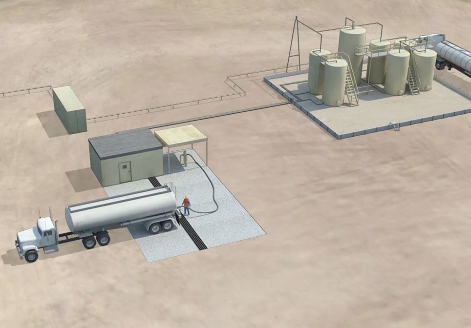
This Saltwater Disposal Well Animation – created by John Perez Graphics & Design, LLC – explains the steps necessary when disposing of salt water that is produced when drilling an oil or gas well. The animation takes you from the surface facilities, through the various protective casing strings down several thousand feet to the pre-approved formation zone where the salt water will be disposed of. This follows the EPA preferred method for the disposal of produced saltwater in Class II Saltwater Disposal wells.
3D Rig Tour
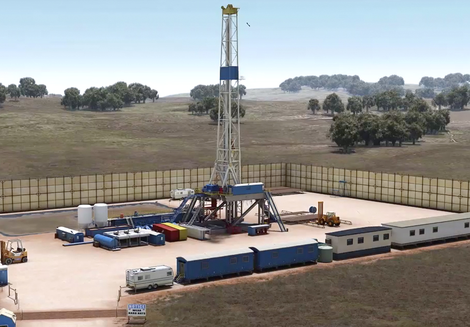
This 3D Rig virtual tour animation takes employees, investors, clients, students and even a jury onto a drill site with the click of a button. The viewer will “fly” around the rig as 37 major components are highlighted, and a narrated description given of each. Animation length: 6:45
Geology 101 - Horst
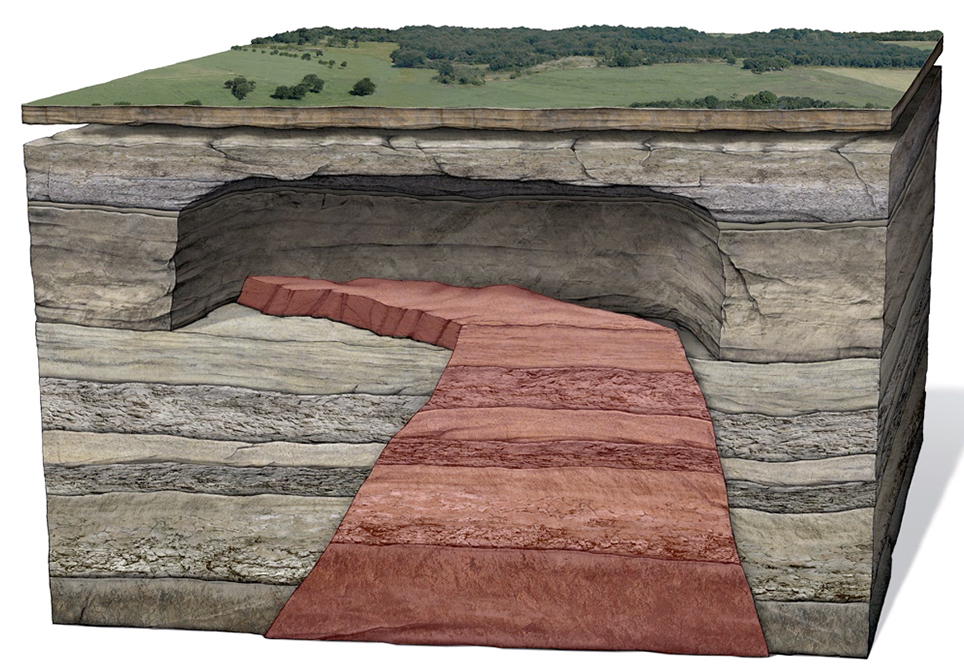
This “Geology 101 – Horst Animation” example explains parts of a Horst.
Blowout Preventer (BOP)
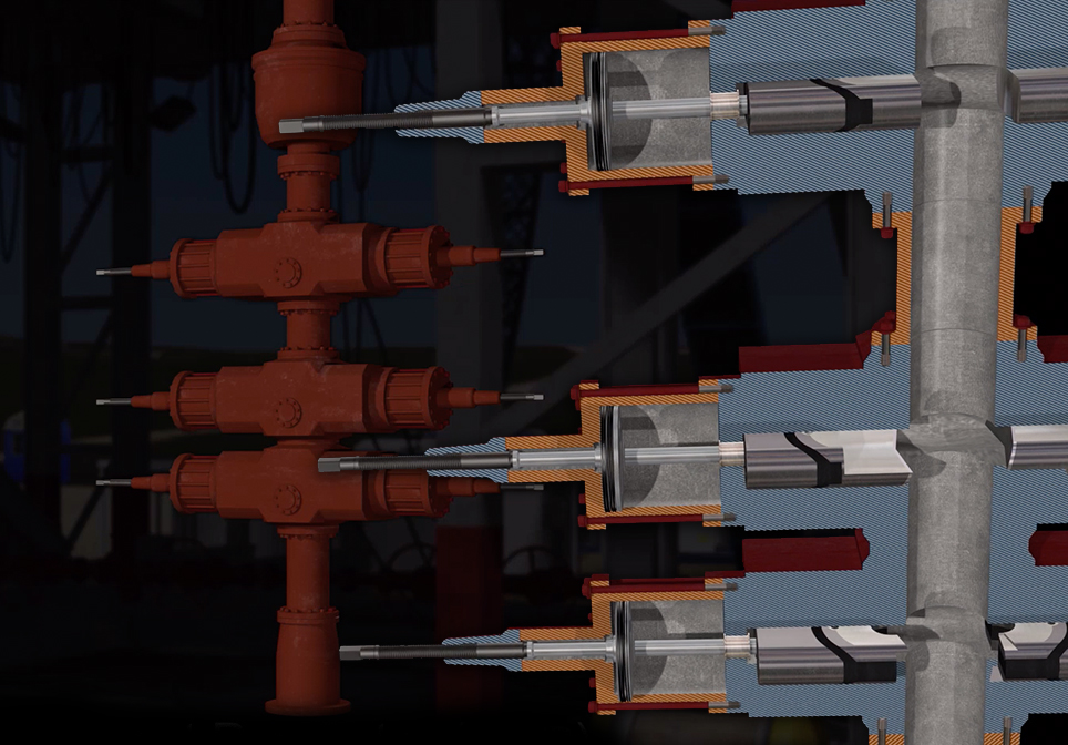
This educational 3d animation “Blowout Preventer (BOP)” is a great addition to our educational library. The Blowout Preventer or BOP is safety equipment designed to prevent uncontrolled flow of formation fluids during drilling and completion operations.
3D Seismic Survey
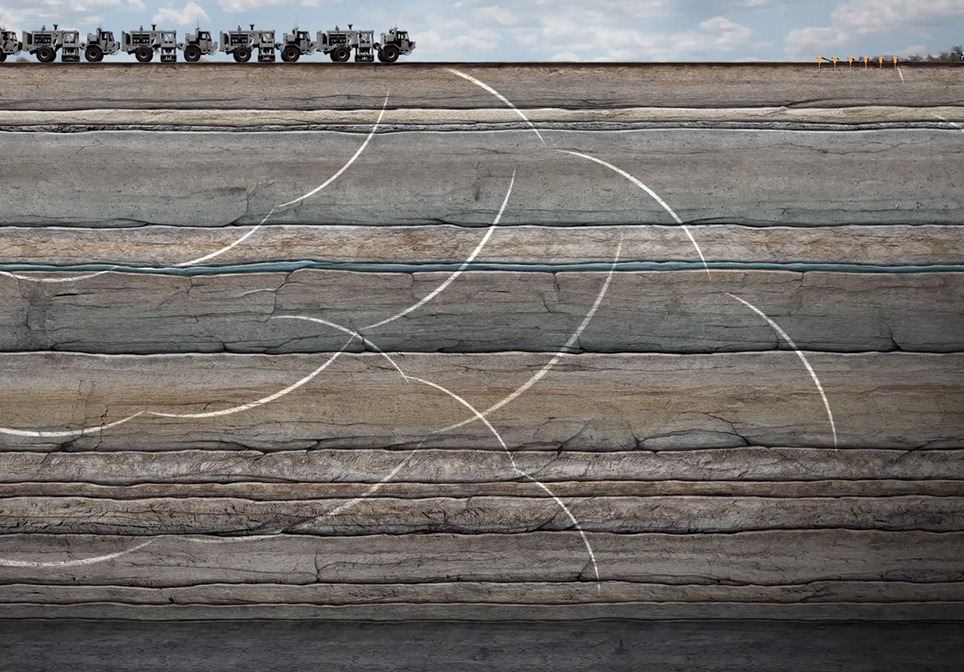
Often companies require addition information as they try to determine optimal locations to drill new wells. A 3D Seismic Survey is one of the most valuable tools used to get a better understanding of the rock formations below.
Introduction to Well Logging
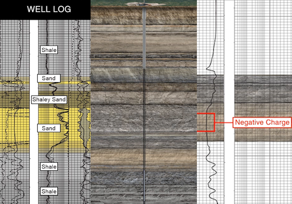
This animation explains the process of logging a well using various tools to measure and determine downhole lithology, determine the presence hydrocarbons, and deem a well commercial for production.
Creation of the Anadarko Basin
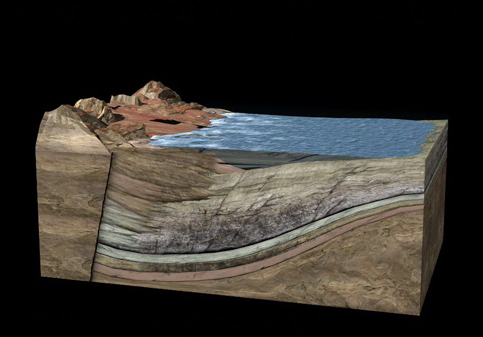
The Anadarko basin of western Oklahoma and the Texas Panhandle is one of the deepest and most petroliferous provinces of the continental United States. This is about to be added to our YouTube Oil & Gas Educational Library
Horizontal Shale Drilling Crude Oil
Ready to watch! This educational animation was just added to our YouTube Oil & Gas 101 Educational Library!
Aquifer Animation Explanation
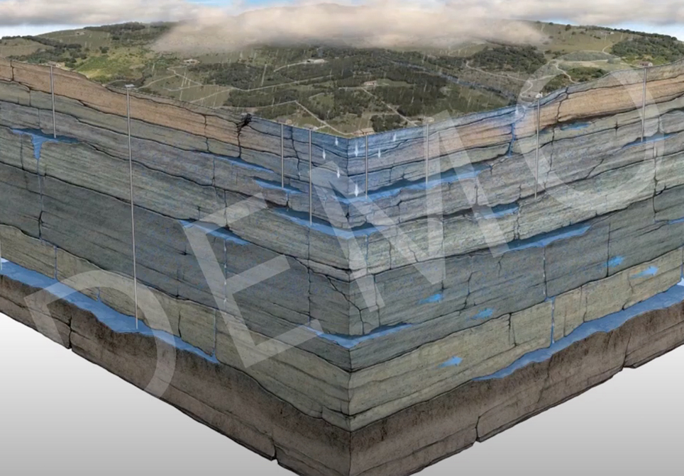
This “Aquifer Explanation Animation” example explains how aquifers work and how they are affected by population growth. All of earth’s water circulates through the hydrological cycle of evaporation, condensation, and precipitation. If you’re drinking a glass of water right now, consider that a dinosaur drank it before you did! All of it has been here as long as the planet itself.
Perfect for:
Teachers – Students – Clients – Employee Training – Investors – Museums – Universities – Geoscience Enthusiasts
Other Animations to Check Out
Story of the Burkburnett Oilfield
Multi-Lateral Stacked Pay